

Before starting any construction project in Kansas City, it’s important to understand the land you’re building on. A topographic survey helps you do exactly that. Whether you’re planning a home, commercial building, or development, this type of land survey provides detailed information about the shape and features of the land.
From knowing where slopes exist to identifying drainage paths, a topographic survey gives engineers, architects, and builders the information they need to plan safely and accurately. In this article, we’ll explain what a topographic survey is, why it’s so important for construction, and how to get one done right in Kansas City.
What Is a Topographic Survey?
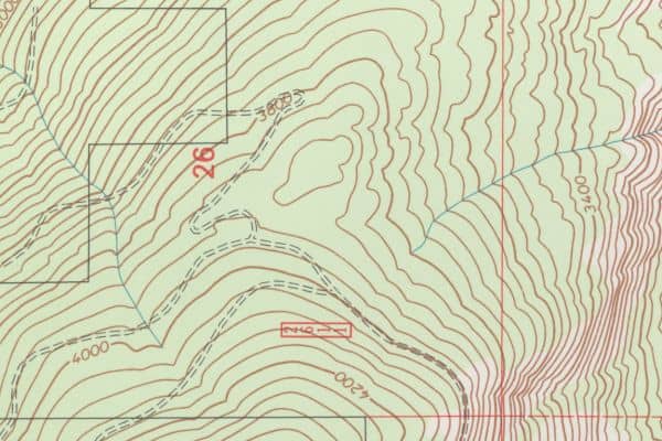
A topographic survey is a detailed study of the land that shows natural and man-made features on a property. It measures land elevations, slopes, trees, buildings, utility lines, and more.
Surveyors use this information to create a map or 3D model of the land. This map helps professionals understand the terrain so they can plan construction projects that work with the land—not against it.
Key Features Measured in a Topographic Survey
- Ground elevation and contour lines
- Slopes and grade changes
- Natural features like hills, trees, and water flow
- Man-made structures such as fences, roads, and buildings
- Utility lines, poles, drains, and sewer connections
Tools and Technology Used
Modern surveyors in Kansas City use high-tech equipment such as:
- GPS systems for accurate location tracking
- Total stations for angle and distance measurement
- LiDAR (Light Detection and Ranging) for creating 3D maps
- Drones for aerial imaging and mapping large areas
These tools make topographic surveys more accurate, efficient, and detailed than ever before.
Benefits of a Topographic Survey for Construction
Topographic surveys are critical for any construction project. Here’s why:
Supports Accurate Site Design and Planning
A topographic survey helps architects and engineers design buildings that fit the land. It shows where the flat areas are, where to place foundations, and how to avoid problem spots.
Identifies Grading and Drainage Needs
Drainage is a big deal in Kansas City, especially during heavy rains. A survey shows how water flows across the property so engineers can design grading that prevents water buildup or flooding.
Ensures Compliance With Local Regulations
Kansas City has rules about how land can be used and developed. A topographic survey helps make sure your plans follow local building codes, zoning laws, and environmental guidelines.
When Is a Topographic Survey Required in Kansas City?
You may need a topographic survey when:
- Building a new home or commercial property
- Adding an extension to a structure
- Developing vacant land
- Applying for construction permits
- Designing drainage or utility systems
Residential vs. Commercial Projects
Both types of projects benefit from topographic surveys, but commercial jobs often need more detailed data because of larger property size, complex drainage systems, and strict building requirements.
Permit and Planning Department Expectations
Local authorities often require a topographic survey to approve building permits. This helps them check for flood risks, zoning issues, and how your project fits into the area.
Topographic Survey vs. Other Types of Land Surveys
While all surveys measure land, they serve different purposes:
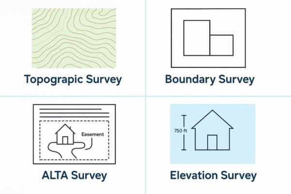
| Survey Type | Purpose |
| Topographic Survey | Shows land features and elevations |
| Boundary Survey | Identifies exact property lines |
| ALTA Survey | Used in commercial real estate transactions |
| Elevation Survey | Used to get flood certificates (FEMA) |
When to Choose a Topographic Survey Over Others
Choose a topographic survey if you’re designing or building a structure and need to understand how the land is shaped and how water drains.
Choosing a Professional Land Surveyor
It’s important to hire a licensed surveyor who understands the land, local laws, and construction needs.
What to Look For in a Surveyor
- Texas licensure
- Experience with topographic and construction surveys
- Familiarity with Kansas City permitting rules
- Use of modern surveying tools
- Clear communication and reporting
Questions to Ask Before Hiring
- How many topographic surveys have you done?
- What technology do you use?
- Can you provide a sample report?
- What is the timeline and total cost?
How Much Does a Topographic Survey Cost?
In Kansas City, topographic surveys typically cost $1,000 to $3,000, depending on:
- Property size and terrain complexity
- Need for detailed mapping or 3D models
- Travel time and research needed
Always request a detailed quote before starting.
Process and Timeline: What to Expect
Here’s how a topographic survey usually works:
- Consultation – You explain your project goals to the surveyor.
- Research – The surveyor reviews old maps, plats, and public records.
- Fieldwork – On-site measurements are taken using GPS or drones.
- Analysis – The data is processed into maps or models.
- Delivery – A final report or digital map is sent to you or your team.
Most surveys take a few days to a week, depending on the job’s size and detail.
Common Mistakes to Avoid
- Skipping a survey because the land “looks flat”
- Using old site maps or guessing elevations
- Hiring unlicensed or out-of-state surveyors
- Not using survey results in planning and grading
Final Thoughts
A topographic survey is a critical part of the construction process—giving you the detailed land data needed to build with confidence. From elevation and drainage to terrain features and regulatory compliance, it helps ensure your project is safe, efficient, and up to code.
Before any construction begins, partner with a licensed Kansas City surveyor to get precise, reliable information. It’s a smart investment that can prevent costly mistakes and set your project up for long-term success.
FAQs
1. What does a topographic survey show?
It shows the elevation, slopes, and features of the land, both natural and man-made.
2. How is a topographic survey different from a boundary survey?
A boundary survey defines property lines, while a topographic survey focuses on land features and elevation.
3. Do I need a topographic survey for a permit in Kansas City?
Often, yes—especially if you’re changing the landscape, building a structure, or installing drainage systems.
4. How long does a topographic survey take?
Most take 3–7 business days, depending on the property’s size and complexity.
5. Can drones be used for topographic surveys?
Yes, many modern surveyors use drones and LiDAR for fast, accurate elevation mapping.
6. Who should perform a topographic survey?
Always hire a licensed land surveyor familiar with Kansas City zoning and permitting rules.